
(SBA) - Iowa Secretary of Agriculture Mike Naig commented on the Iowa Crop Progress and Condition Report released by the USDA National Agricultural Statistics Service. The report is released weekly April through November. Additionally, the Iowa Department of Agriculture and Land Stewardship provides a weather summary each week during this time.
“Northwest Iowa is experiencing historic flooding not seen since 1993. While the forecast is showing a reprieve from additional rainfall, those downstream need to be prepared as this water heads south,” said Secretary Naig. “Our hearts go out to all the Iowans affected by this devastating flooding. We do not yet know the full picture of damage to homes, businesses, farms, crops, livestock, communities and public infrastructure, but we know that it is likely to be substantial and costly. Iowans are resilient and we will get through this together, but this recovery will certainly take some time and require considerable resources.”
The weekly report is also available on the USDA’s website at nass.usda.gov.
Crop Report
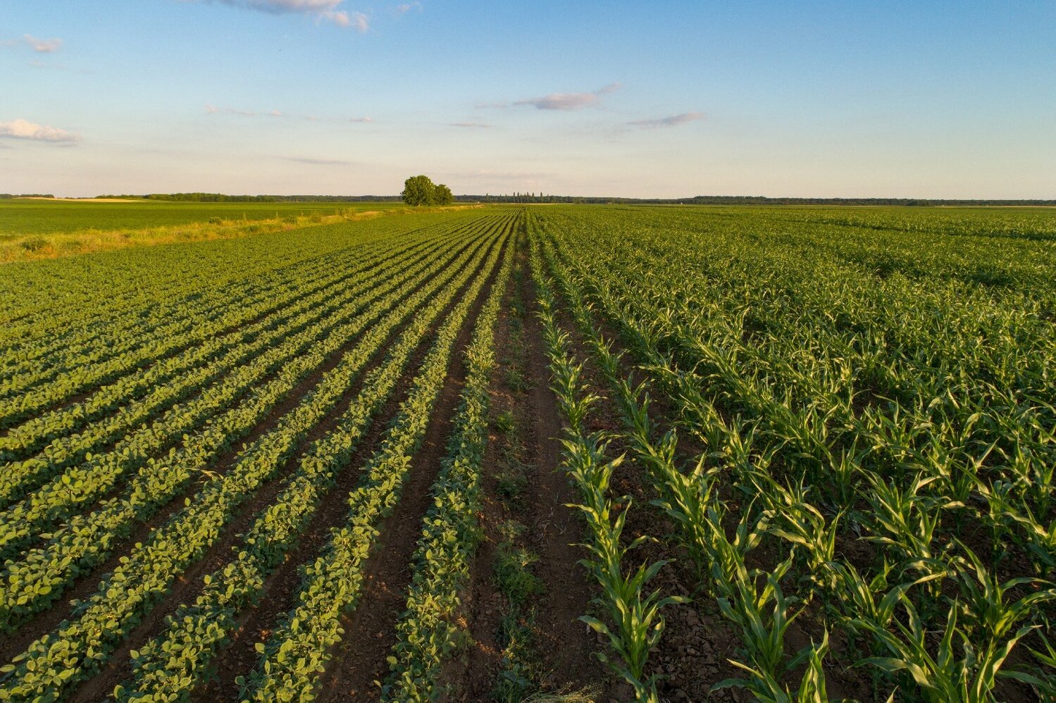
Northwest Iowa farmers received substantial rainfall with flood conditions while some Southeast Iowa farmers had minimal precipitation. Statewide there were 3.9 days suitable for fieldwork during the week ending June 23, 2024, according to the USDA, National Agricultural Statistics Service. Spraying and other field activities were limited in some areas due to wet field conditions.
Topsoil moisture condition rated 1 percent very short, 8 percent short, 74 percent adequate and 17 percent surplus. Subsoil moisture condition rated 1 percent very short, 11 percent short, 71 percent adequate and 17 percent surplus. Excessive rain fell in northwest Iowa with over 50 percent of the area reported with surplus topsoil and subsoil moisture.
Corn emergence neared completion. Corn condition rated 77 percent good to excellent. Soybeans emerged reached 95 percent. Seven percent of soybean crop was blooming, 1 day behind last year but 2 days ahead of the 5-year average. Soybean condition rated 74 percent good to excellent. Eighty-six percent of the oat crop was headed or beyond, 6 days ahead of the average. Twenty-eight percent of oats were turning color, 9 days ahead of the average. Oat condition rated 73 percent good to excellent.
Ninety-five percent of the State’s first cutting of alfalfa hay has been completed, 6 days ahead of last year. Hay condition rated 78 percent good to excellent. Pasture condition decreased two percentage points to 73 percent good to excellent. Feedlots remain muddy due to excess rainfall.
Weather Summary
Provided by Justin Glisan, Ph.D., State Climatologist, Iowa Department of Agriculture and Land Stewardship
A large-scale heat dome over the eastern United States set up a weather pattern known as a “Ring of Fire” which produced several waves of heavy rainfall from disturbances propagating over the Upper Midwest; some stations in northwest and north-central Iowa received several months’ worth of rainfall, on the order of 300-600 percent of normal. Farther southeast, temperatures were six to eight degrees above normal with the statewide average temperature at 75.4 degrees, 4.0 degrees above normal.
Showers and thunderstorms pushed out of eastern Iowa early on Sunday (16th) afternoon as clouds cleared west to east. Southerly winds increased as temperatures rose into the mid to upper 80s with lower 90s from central to southwest Iowa. Clouds increased over northwest Iowa overnight into Monday (17th) as a strong low pressure center pushed along the Iowa-Minnesota border. Thunderstorms along the initial line were severe warned with reports of straight line winds and very heavy rain. There was a brief lull in thunderstorm activity through the afternoon hours as daytime highs reached the low to mid 90s in eastern Iowa. Thunderstorms refired across northwestern Iowa and sped east into the evening; four stations in Dickinson County observed totals from 2.60 inches in Lake Park to 4.76 inches at Spirit Lake with almost 30 stations registering at least an inch. Partly cloudy skies persisted over southern Iowa through Tuesday (18th) morning with unseasonably warm morning temperatures in the mid to upper 70s. Afternoon temperatures in the 80s coupled with higher dew points ahead of a strong cold front helped strong to severe thunderstorms form over western Iowa during the early evening. The line, initially narrow and concentrated, expanded and lost strength as it moved through central Iowa. Redevelopment occurred into Wednesday (19th) and persisted over central and eastern Iowa into the nighttime hours. Event rain totals were highest southwest, central and east with most Iowa stations accumulating at least 0.50 inch. Thirty stations observed 2.00 inches or more with 3.00 inches in North Liberty (Johnson County) to 4.30 inches in Creston (Union County) and a statewide average of 0.86 inch.
A stationary front draped across the state was a forcing mechanism for slow moving showers and thunderstorms along the Iowa-Minnesota border on Thursday (20th). Several flash flood warnings were issued for northwestern counties as three Rock Rapids (Lyon County) stations reported from 5.45 to 6.20 inches. Totals for adjacent counties were also anomalously high, ranging from 3.20 inches in Sheldon (O’Brien County) to 3.87 inches at Estherville Municipal Airport (Emmet County). Skies remained overcast across much of northern and eastern Iowa into Friday (21st) as another disturbance slowly propagated through northern Iowa as scattered thundershowers popped across southern Iowa. Widespread and slow moving thunderstorms brought additional higher-end totals on top of the previous day’s accumulations that were already more than a month’s worth at several stations. Seventy five stations reported an inch with 26 locations registering at least 3.00 inches. The highest totals ranged from 4.18 inches in Milford (Dickinson County) to 5.50 inches in Forest City (Winnebago County). Amounts tapered off to a few tenths of an inch in southern Iowa with an overall statewide average of 0.78 inch. The complex continued into northeastern Iowa by daybreak on Saturday (22nd) with morning lows in the upper 60s northwest to upper 70s southeast. Afternoon temperatures were in the mid to upper 80s in eastern Iowa as a cold front clashed with the warm and saturated airmass during the evening hours. A few storms were tornado warned, though nothing was observed on the ground. Heavy rain fell in the northeast with 2.12 inches in Oelwein (Fayette County) to 2.59 inches in Waukon (Allamakee County) with most of eastern Iowa registering 0.25 to 0.50 inches. Skies cleared overnight as winds shifted to the northeast behind the front. Sunday (23rd) morning was pleasant with lows in the 60s.
Weekly precipitation totals ranged from 0.04 inch at Donnellson (Lee County) to 12.98 inches in Lake Park (Dickinson County). The statewide weekly average precipitation was 2.76 inches while the normal is 1.17 inches. Williamsburg (Iowa County) reported the week’s high temperature of 95 degrees on the 17th, 14 degrees above normal. Multiple stations reported the week’s low temperature of 56 degrees on the 17th and 20th, on average two degrees below normal.


